Real-time, crowdsourced flood data
Supporting urban adaptation to climate change in Ghana

FloodNavigator’s mission is to enhance safety, mobility, and resilience in flood-prone regions through real-time, crowdsourced data that empowers communities to adapt to climate change.
Community-led resilience
Our theory of change is rooted in community partnership, cultural understanding, and a go-to-market strategy designed around social resilience.
Accessibility
Our web app is compatible across platforms and leverages widespread mobile phone use.
Safety first
FloodNavigator was designed to prioritize user privacy and safety, guided by the principles of the Privacy by Design (PID) framework
Reliability
FloodNavigator uses community moderation tools to keep the map accurate in real time. As more data is collected, we’ll introduce confidence scores based on hydrology models, user engagement, and weather data.
Simple
Users can report flooding to their community through the app with two simple steps: tap “report” and confirm or adjust their location.
Democratizing information
FloodNavigator empowers users to access real-time flood data, ensuring that critical information isn’t siloed but available to all.

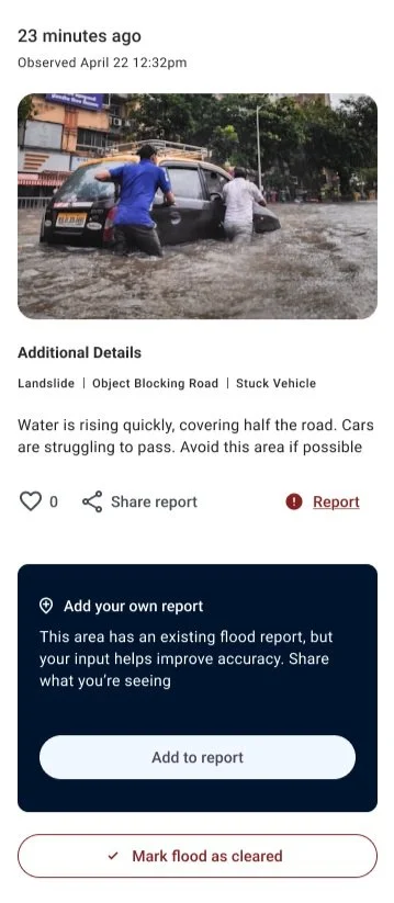
Edit Flood Reports
Users can add to existing flood reports or “mark flood as cleared” to help enhance its real-time accuracy. Users can also provide feedback to a report by marking it as “helpful” or reporting it if they believe the information is fraudulent or inappropriate in any way. Once flagged, reports will temporarily be removed from the map pending review by our team.
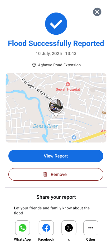
Share Flood Reports
Users can share their own reports as well as others’ flood reports on WhatsApp and other social media platforms.
Report Floods
Users can report flooding to their community through the app with two simple steps: tap “report” and confirm or adjust their location. From there, they can optionally add details like a photo, flood severity, traffic conditions, or infrastructure impacts.
View Flood Reports
Reports appear as interactive pins on an OpenStreetMap-based interface, which other users can view. Users can view flood reports nearby or anywhere in the world, regardless of whether they choose to share their location information or not.